Introduction Study area Method: Photogrammetry Method: Water depth estimation Final riverbed surface Conclusions References Links & Acknowledgements

|
Introduction Study area Method: Photogrammetry Method: Water depth estimation Final riverbed surface Conclusions References Links & Acknowledgements |
|
2: Study area
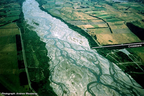
The study reach is a 3.3 km reach of the lower Waimakariri river, approximately centred on Crossbank, around 18 km from the river mouth (Figure 1). Crossbank is part of a network of artificial groynes and stopbanks that have confined the active riverbed to around 1 km wide, about one quarter of its natural width. Furthermore, Crossbank has been reported to be the current-day location of the 'hinge-point' between upstream post-glacial down-cutting and downstream deposition of the gravel load from this down-cutting into an alluvial fan (Carson and Griffiths, 1989).
Figure 1 An aerial view of the Waimakariri river study area in December 1999, looking downstream. Crossbank is visible on the true right-hand bank.
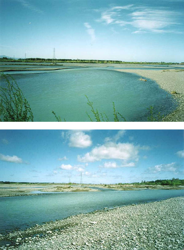
At the study site, the riverbed has a relatively low vertical relief (typically less than 1 m) and is composed of heterogeneous gravels and sands (Figure 2). Mean annual flow is 120 m /s (Griffiths, 1979), with the entire floodplain becoming inundated at flows of around 800-1000 m /s (Hicks et al., this volume), which typically happen several times each year.
Figure 2 The typical topography of the Waimakariri study reach at Crossbank. The electricity pylons give an idea of scale.
Introduction Study area Method: Photogrammetry Method: Water depth estimation Final riverbed surface Conclusions References Links & Acknowledgements