|
|
|
|
Study reach
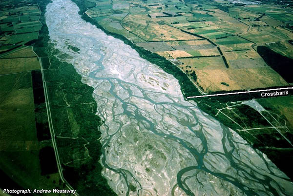
Our study reach at Crossbank, 7 km north of the city of Christchurch, is approximately 4 km long (Figure 1). The overall bed slope is 0.0048 while the d50 of the gravelly bed material is 28 mm (Carson and Griffiths, 1989). The mean flow is 120 m3/s, the mean annual flood is 1520 m3/s, the suspended sediment load is 3.1 Mt/yr (D. M. Hicks, unpublished data), and the bedload is approximately 210,000-250,000 m3/yr (Carson and Griffiths, 1987).
Figure 1. View downstream along the study reach of the Waimakariri River at Crossbank. Photograph taken December 1999 by Andrew Westaway.
The river is confined to a straight, 1500 m wide course by stopbanks, and this width has been further reduced by belts of willows on either bank so that the area of active, unvegetated riverbed averages approximately 1000 m in width. Short (100-200 m long) 'stub' groynes protruding through the willow belts generally maintain the balance between vegetated and unvegetated riverbed. The study reach riverbed becomes totally inundated at flows exceeding about 800-1000 m3/s.
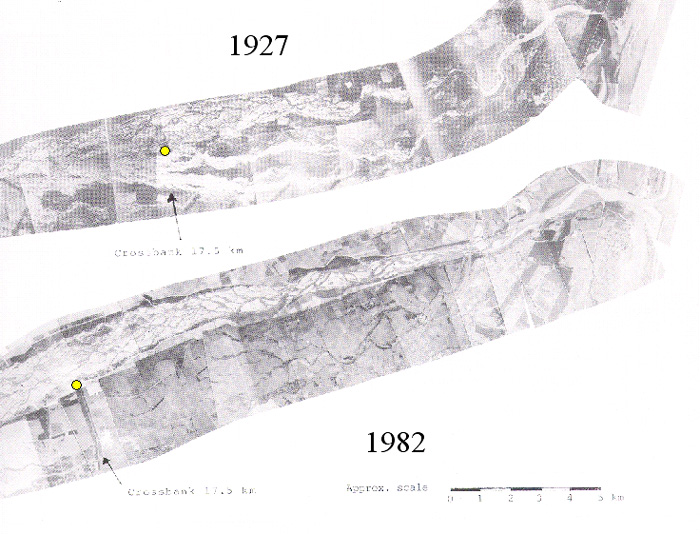
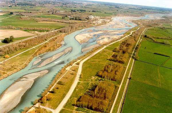
Before stopbank construction, the riverbed at Crossbank was unconfined and was approximately 4 km wide, with braided channels passing either side of a large island (Figure 2). Several kilometres downstream from the study reach, the stopbanks converge, the river progressively narrows to less than 400 m wide, and the channel pattern changes from braiding to an alternate bar morphology (Figure 3). Naturally, this reach was constructing an alluvial fan. After confinement, the deposition of gravel has been concentrated into a narrower width and aggradation has been controlled by aggressive gravel mining. Some 300,000 m3/yr are extracted (Carson and Griffiths, 1987). Bedload transport during floods was studied in the reach immediately upstream of the study reach by Carson and Griffiths (1989), while the sedimentation history of the lower Waimakariri channel has been reported by Griffiths (1979) and by Blakely and Mosley (1987).
Figure 2. Historical changes in the channel patterns of the Waimakariri River. In 1927, the river at Crossbank (the study reach location, marked with a yellow dot) was unconfined; by 1982 it was confined by stopbanks. From Blakely and Mosley (1987).
Figure 3. View upstream along the confined reach of the Lower Waimakriri River. Although semi-braided, the main channel meanders around alternate bars. The study reach at Crossbank lies immediately upstream of this view.